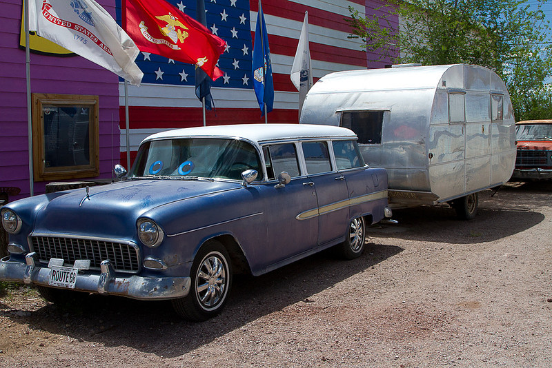
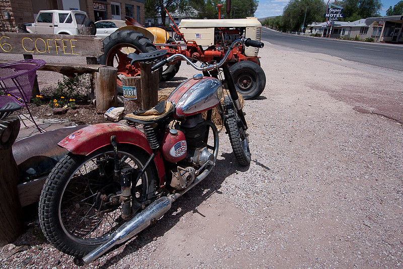
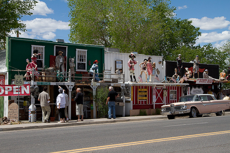
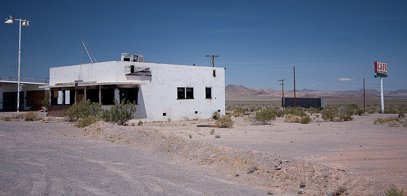
RT-66 Then and NowRoute-66 Then and Now(Published May 2026) As 2026 is the 100th anniversary of Route-66, I decided to publish this. It contains excerpts related to Route-66 from some of my prior travel articles. My travels on Rt-66 have been limited to sections in California, Arizona, and a bit in New Mexico so that’s what you’ll find in this article.
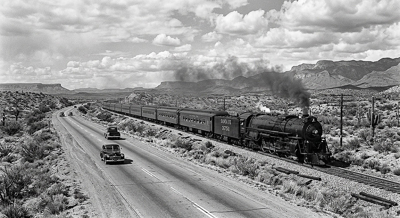
As we know the transcontinental railroads opened the west. Rail lines were designed to run from city to city. Even before the tracks came along people had been going from city to city by horse, wagon, carriage, and on foot and in the process had inadvertently created make-shift dirt ‘roads’ along the easiest routes. So, naturally the train folks tended to follow those old roads when they laid their tracks But trains are not the only story of travel in the southwest USA. It wasn’t too long after the railroads opened the Southwest that affordable motor cars started to be produced and people starting driving these old roads. Before the creation of the “US Highway” system in 1926, these old intercity roads in the wide open spaces west of the Mississippi River were just those same impromptu pathways, many of which now paralleled rail lines. (AI Generated Image)
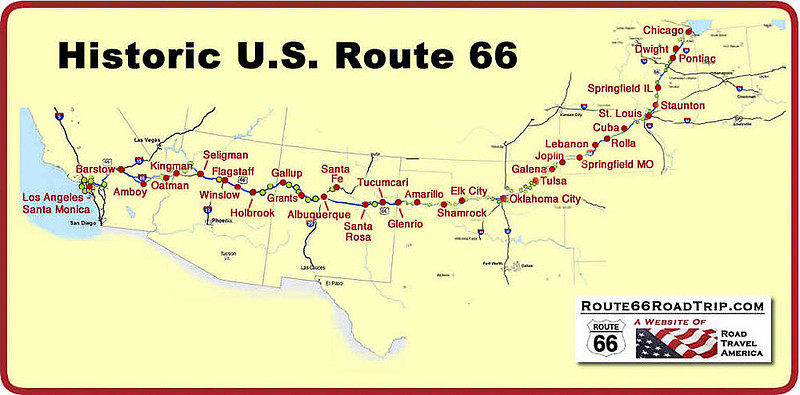
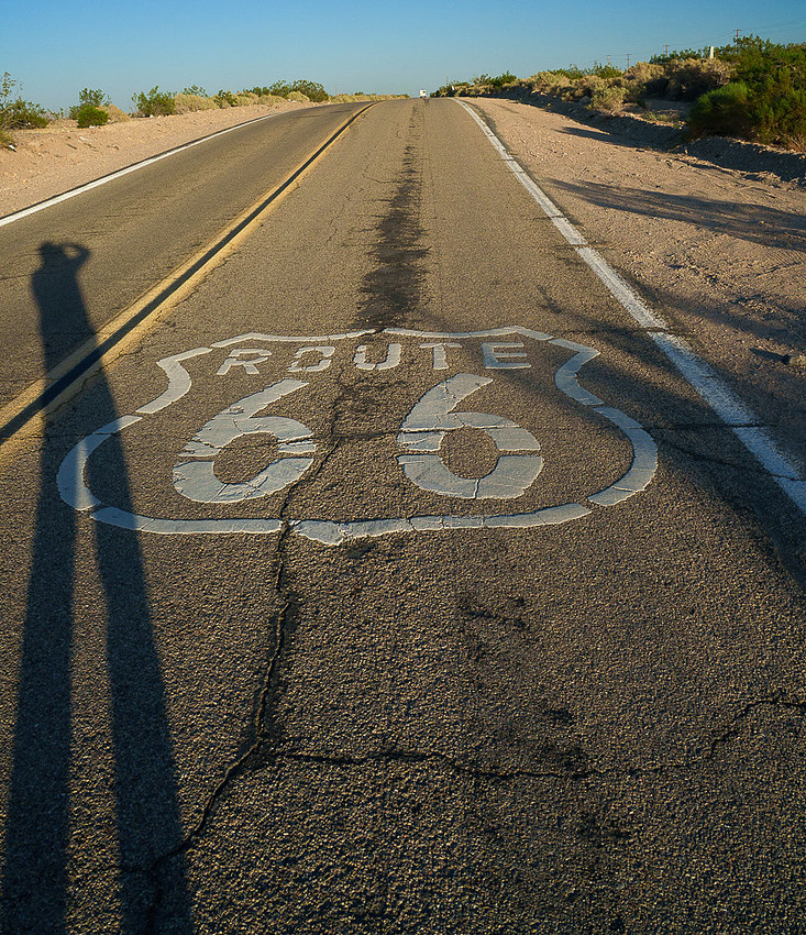
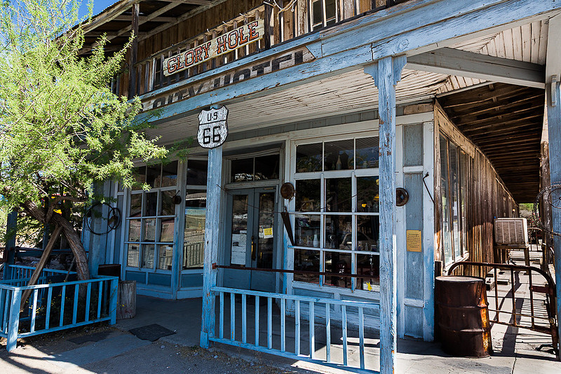
As I said, these were mostly just dirt ruts but sometimes a county or state would provide some improvements such as some gravel or on rare occasions a bit of pavement. But for the most part these were just rural dirt roads. Before the mid 1920’s, these ‘roads’ were generally not numbered and were only known by the town names at either end of a section of dirt road. With such a naming system, a road would change its name each time it passed through a town. But, that didn’t really matter as there were no signs or markers showing the name anyway. Sometimes a traveler could find a booklet explaining how to get from one place to another. Many times these booklets were written through hearsay by people who had never been anywhere near the area they were describing. Getting totally lost was as prevalent for those with these books as for those without them. Whether you used a booklet or just asked locals for directions, the instructions used landmarks to direct the traveler since there were no signs or road numbers. You’d find things like “bear left at the fork in the road by a big Oak tree a bit past a dry creek where there is a broken wagon by the side of the road.” This was quite a bit more challenging to follow than a giant green sign over your lane saying “Las Vegas, I-15 exit left 1 mi.” But then in the 1920’s the US government decided that having a national road system of numbered roads would be good for commerce and tourism as it would allow people to follow marked and numbered roads long distances on paved highways. And so in 1926 they created the US Highway system. One of the first routes under this new program was the famous Route 66, also known as the "Main Street of America" or the "Mother Road." It ran from Chicago, through the Midwest farmlands of Illinois, the rolling hills of the Missouri Ozarks, through the mining towns of Kansas, across Oklahoma where the woodlands of the East meet the open plains of the West, through the open ranch lands of Texas, then the colored mesa lands of New Mexico and Arizona, through the Mojave Desert, and finally to the “milk and honey” land of metropolis Los Angeles winding up at the Pacific Ocean in Santa Monica. Photographing RT-66 Route-66 played a significant role in the development of the American Southwest and became an iconic route for travelers connecting many communities and serving as a major transportation corridor for decades. The US Highway System was more a project to number, pave, and mark existing roads than to build new highways. The result was generally 2 lane roads which went through the center of every town along its route. These highways were clearly, and frequently, marked with distinctive shield shaped signs containing the road number. You could get on Route-66 in Chicago and follow the same route number signs all the way to Santa Monica California many days later without once having to look for an old Oak tree just past a dry creek, or finding a left turn at the red barn. And, as most all of these were paved, you could whoop it up to 35 or 45 miles per hour and not be shaken to death by the ruts and washboard surfaces of dirt roads or choked to death by road dust of passing cars and trucks. Route-66 was officially decommissioned as a U.S. highway in 1985 due to the development of the Interstate Highway system which are all multi lane limited access (no cross streets) highways. In the desert SW it was I-40 which replaced RT-66 and in most places actually were built right over the old RT-66 destroying the old road. But the RT-66 legacy lives on as a symbol of American road travel in the 1940’s 50’s and 60’s. Even though RT-66 was decommissioned and replaced by Interstate highways, there are still many drivable sections of old US-66 in the SW which were not buried under the new interstate. Many of these sections have remnants of abandoned and decaying gas stations, restaurants, motels and even towns. Some towns like Oatman and Seligman have cashed in on the Route 66 mystique and nostalgia where they have resurrected these old buildings (or built new ones to look like the old ones) to cater to the tourist trade. In NW Arizona there are several good size sections of old Route 66 where I-40 didn’t follow the old US-66 right of way. Here are two of them between the CA border and the Flagstaff. I’m sure there are many more in other regions. AZ-10 from Topock to Kingman, AZ.
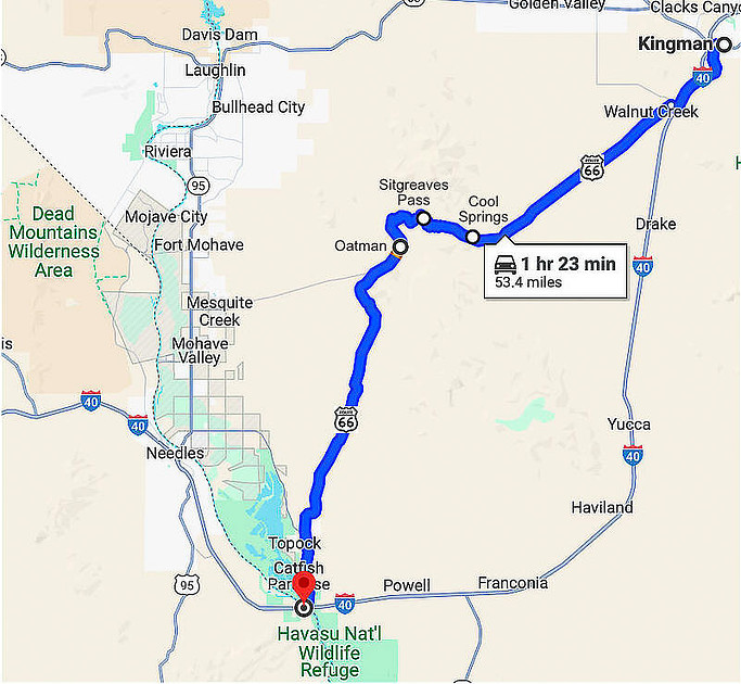
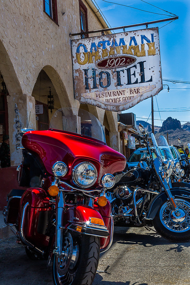
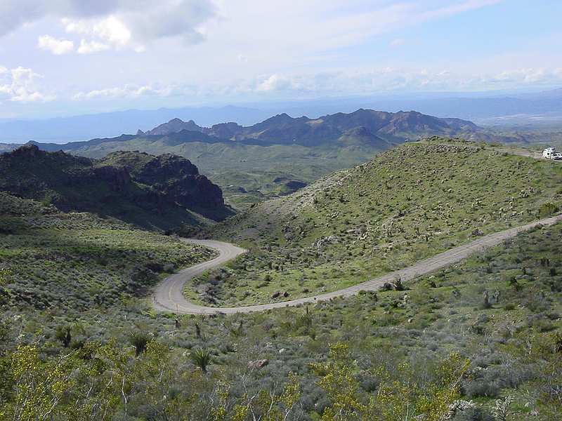
Topock is a bit north of where I-40 crosses the Colorado river (CA-AZ border). This 53 mile stretch exists today because I-40 went around the Black Mountains rather than over them as Rt-66 did. From Topock, it is mostly flat desert till you get near Oatman but then it climbs into the Black Mountains. Oatman is still an operating town catering to the Route-66 tourists with old buildings still in use including restaurants, souvenir shops, and hotels. When the US-66 route was being chosen, Oatman was a prosperous gold mining town. Through heavy lobbying (and most likely some of that gold finding its way into politicians pockets), an alignment that passed right though Oatman was selected – even though it was anything but practical. And, if you think about it, had RT-66 followed the set of old roads where I-40 is now, this entire stretch of old RT-66 would not exist. Oatman, AZ (2013) Oatman, AZ (2013) Heading NW out of Oatman, this section of Route-66 goes over Sitgreaves Pass in the Black Mountains. At 3,550 ft, this pass is not the highest point on Route-66 - which after 1942 was just west of Flagstaff at 7,335 feet - it was the most challenging to drive. This is a very winding road including hairpin curves with several long very steep grades of up to 12% going over ridges between small valleys. Even though Sitgreaves pass is only 3,100 feet higher than Topock, once you add in all the ups and downs, long steep grades, summer temps over 100 degrees, and the lousy cooling systems in cars of the era it was given great respect by drivers and approached with caution. In today’s cars though you hardly notice such steep driving conditions – even with the AC on. We’ll talk more about this a bit later in this article. AZ-66 from Kingman to Seligman AZ
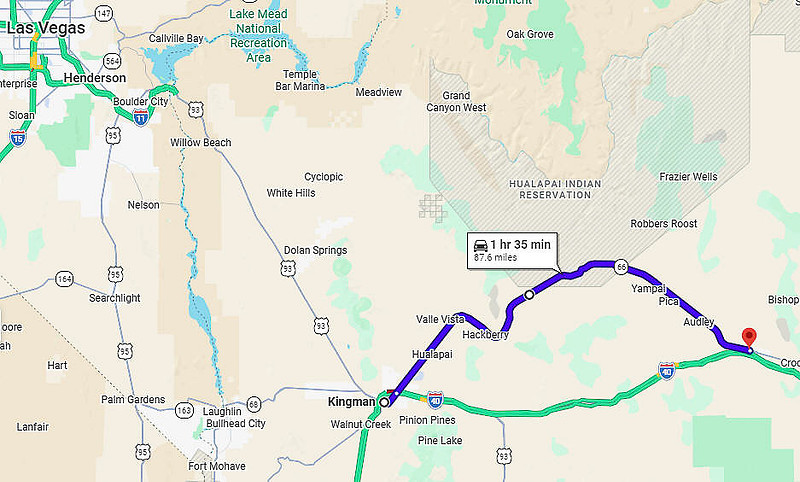
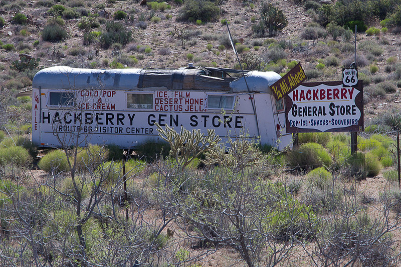
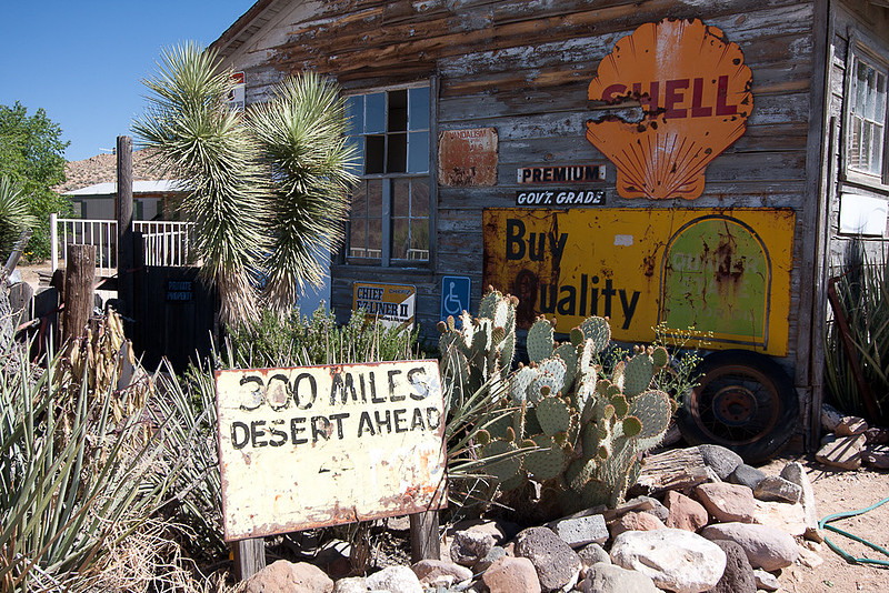
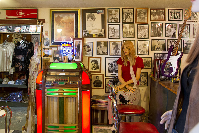
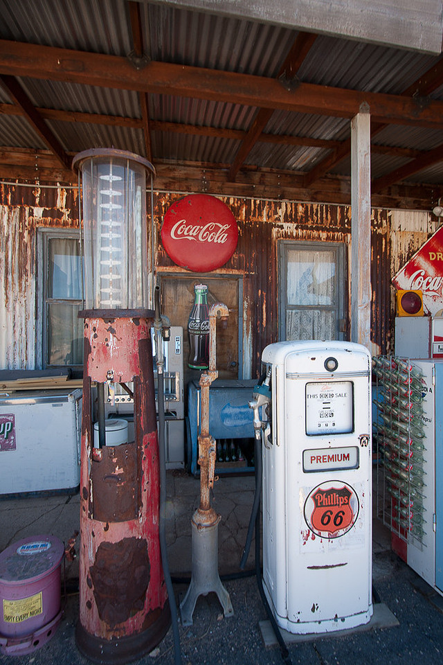
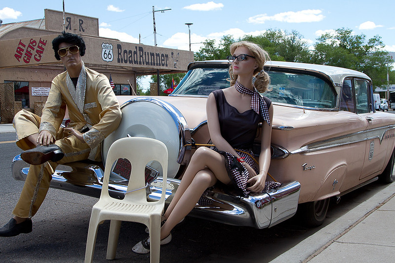
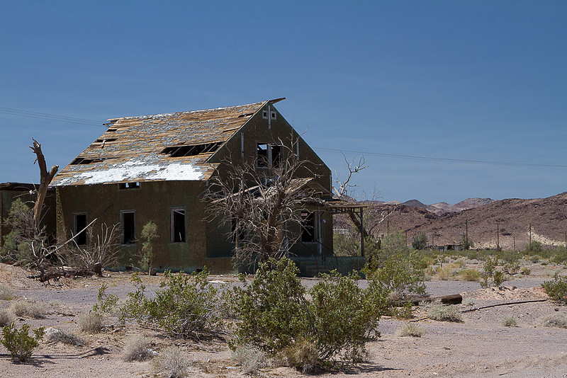
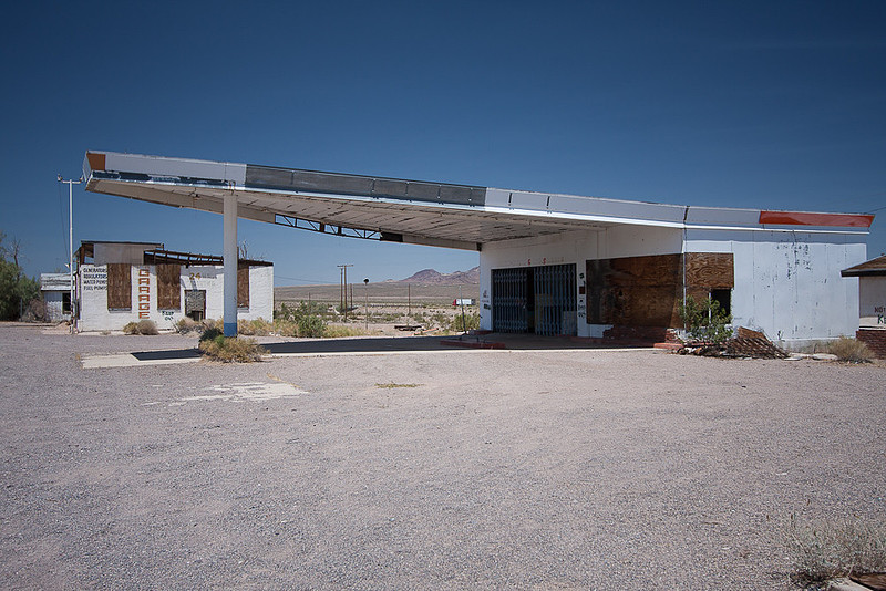
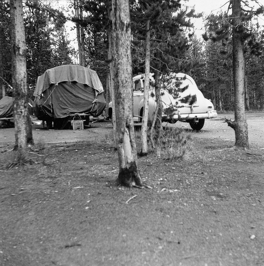
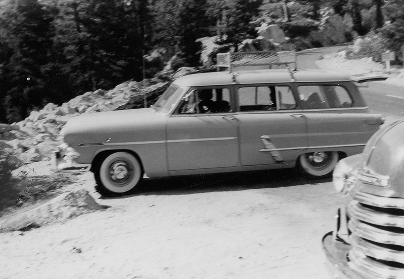
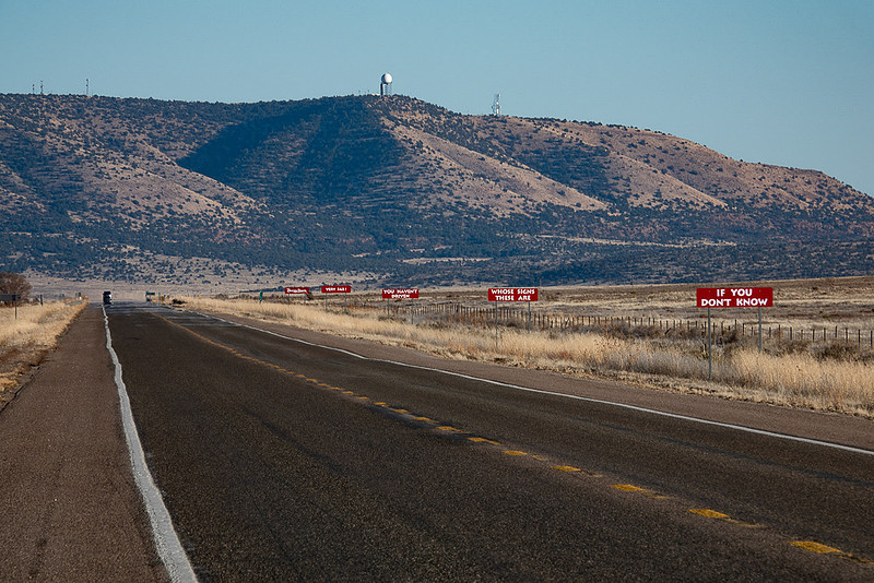
This is a 87 mile stretch that today takes about 1hr 35min. The road passes through many small towns and passes many ruins of abandoned buildings. One of these places is Hackberry which is an old gas station and café turned tourist attraction and museum. Promotional signs just before getting to Hackberry Hackberry, AZ Museum/gift shop in Hackberry Hackberry, AZ This section of old US-66 meets up with I-40 at Seligman but you can continue on old US -66 (Now AZ-66) another 15 miles to where it meets up with I-40 again and ends. Seligman, being right next to I-40, is a flat-out, no holds barred tourist trap. It is over the top ticky-tacky-cutesy taken to the extreme. In other words perfectly made for the iPhone selfie crowd. If you are trying to make time on I-40 and want a taste of Route-66 taken to the extreme, pop off here for 30 minutes and look around. Elvis and ??? in Seligman (2011) Props in Seligman, AZ (2011) Possibly and old Indian brand motorcycle? Seligman, AZ (2011) No comment. Seligman, AZ (2011) Ludlow (CA)But even if you don’t have time to drive one of those long original US-66 sections there are loads of short sections just off of I-40 with ruins and remnants which have not been commercialized. Just keep your eyes peeled as you approach interchanges in the middle of the desert which have no apparent reason for being there and have nothing there except perhaps a gas station. Many times these exits let you access Old Route-66 paralleling the freeway a few hundred yards away. One example is Ludlow (52 miles east of Barstow, CA on I-40) where there is just an exit with a gas station. Here is a Route-66 section paralleling I-40 and within a mile east on old 66 is the old abandoned remnants of Ludlow. Ludlow (2011) Abandoned homestead. Probably for the owner of the café and gas station Abandoned gas station Remembering car trips in the 1950’sAs our Motel in Barstow one one of our trips was on old RT-66 at the east end of Barstow and we had a few hours of daylight left, I asked the clerk if there were any old sections of the classic road nearby that might feature abandoned relics of the old highway. He said “I think there’s a section that might have some ruins a few miles East on I-40, just past the Marine base. Exit at Nebo St.. and cross under the freeway”. So off we went in search remembrances of my youth from the mid to late 1950’s. And, indeed there was a section of old RT-66 at Nebo St. exit. We drove about 20 or 30 miles east on it but really didn’t find any ruins to photograph. We did find some old slabs of concrete where a gas station might have been and the odd foundation where a house or store might have been, and an old structure that might have been an inspection station, but time and progress hadn’t left much. In the 1950’s our family lived in Los Angeles and as we were mostly at the lower end of middle class at the time, our vacations were always of the driving/car-camping variety with perhaps a motel along the way. We would go to Lake Tahoe, Yosemite, the Grand Canyon, Bryce, Zion, Death Valley, Joshua Tree or any number of other destinations in the Southwest that were no more than a few days drive away. Every now and again when there was some money we’d venture farther to places like Yellowstone, Glacier, or Crater Lake. But even though the destinations varied, the trips were all quite similar. They were always in mid summer and we’d sweat through long hot driving days up the Central Valley in California on US-99 (no AC in those days and barely any radio) or we’d head east on US-66 across the Mojave desert and into Arizona, Nevada, and then up into Utah or head south into the desert areas south of Los Angeles. In the beginning, I recall a green Chevy sedan and according to this archive photo, we pulled a little flatbed trailer with a canvas tent nailed to it. I assume we collapsed the tent for driving and piled the camping gear on top. I don’t remember much about this car except that was very prone to overheating. Family Image from unknown location in very early1950’s But mostly I remember using station wagons. Mostly Ford’s as I recall. 1954 image at Mount Lassen. My memories of those trips are spotty as I was mostly under 10) but I do recall many things like mom and pop motels, nineteen (or even seventeen) cent hamburger joints, road side attractions like reptile zoos, and A&W root beer stands where you could get a large frosty glass mug of root beer for a nickel and on special occasions with a scoop of ice cream. And there were those famous Burma Shave signs that we all looked forward to stumbling upon as we cruised down a desert highway. These were little 4 line poems where each line of the poem was on a separate sign with a 5th sign just saving “Burma Shave”. Whenever a set of these signs came into view, we’d all sit up and read them aloud as we zoomed by. They started out as promoting the product. For example
THE HERO WAS BRAVE or MY JOB IS But later they ventured into driving topics such as
DON’T STICK YOUR ELBOW Or IS HE LONESOME
I understand that there are still a few places that have these signs (probably not originals) as in the photo below. Photo by: John Fowler from Placitas, NM, USA (Creative Commons Attribution 2.0 Generic) Here’s a link that lists 90 of these Burma Shave poems https://thewhynot100.blogspot.com/2015/06/90-brilliant-burma-shave-signs.html Cars in those days always seemed to have an overheating problem and driving through the Southwest deserts in the summer really stressed those old cooling systems. After years of experience, much of it pre-dating the arrival of my brother and I, dad was pretty savvy about desert driving. Of course this didn’t prevent the car from over heating, it is just that he tended to know how to deal with it. There were two problems you needed to watch out for with hot or mountainous driving. One was just plain overheating (or boiling over) which could blow a radiator hose or burst a radiator if you let it get too bad. A second issue was something called “Vapor Lock”. This is when things got so hot in the engine compartment that the fuel in the fuel line would vaporizes before reaching the carburetor thereby stopping the flow of gas. If you had water, with you, boiling over could be dealt with in an hour or so, but vapor lock many times required waiting till late at night for the fuel system to start working again as pouring cold water on a hot engine was not a smart thing to do unless you desired buying a new engine. (Image from Internet)
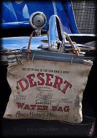
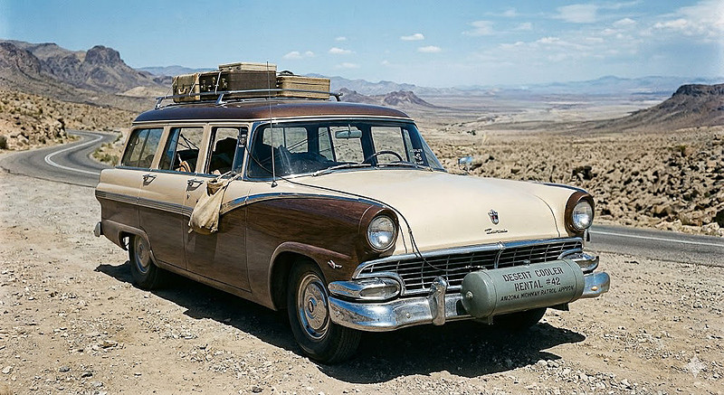
When driving in the desert, my dad had a couple of burlap water bags that he’d hang on the front bumper where the wind would keep them cool. When the car overheated we’d use them to refill the radiator. In order to avoid an explosion of water and steam, we’d usually have to wait awhile by the side of the road for the engine to cool down enough to take the radiator cap off – and with any luck there’d be a shade tree nearby to block the desert sun on those 100+ degree days. While waiting dad would hunt for a rag to keep from burning his hand when the time came to pop the radiator cap. What you’d do is wrap the rag around your hand several times then turn the cap ¼ turn (or later lift a lever on top). This would allow steam to escape in a controlled manner till all the pent up pressure was relieved and you could take the cap all the way off. If you were silly enough to just unscrew the cap, the pressure would blast the cap skyward on top of a geyser of water and steam and hopefully neither the cap or scalding steam and water would hit you in the process. But, then you’re entire family could bond while searching several hundred feet in all directions for where that airborne radiator cap had landed. Knowing about the steep climb up to Sitgreaves Pass, on US-66 between Topock and Kingman, my dad would rent a device to keep the car from boiling over. This was a metal tank which was a cylinder about 4 feet long and as I recall about 8 or 9 inches in diameter that he’d hang crosswise on the front bumper. It had a little pump which he’d hook up to the battery and run a wire to a switch mounted on the triangular “vent pane” window that cars had at that time. When turned on, water was pumped through a couple of sprayers aimed at the front of the radiator. Cars also had a water temperature gauge on the dashboard and whenever the engine temp would get near the red line he would flip the switch to turn on the pump and spray water on the radiator and the engine temp would come back down. As we ascended those long grades I remember the “swosh, swosh, swosh” sound of that pump which would pulse like a Rainbird sprinkler as we passed car after car on the side of the road with the hood up and steam coming out of the radiator. Remember: “Everybody yearns for the good old days but grandpa”. (AI generated image from my description. Pretty close to what I recalled)
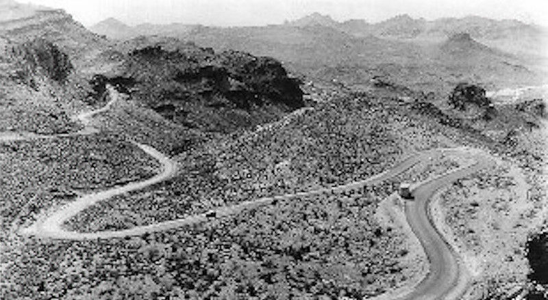
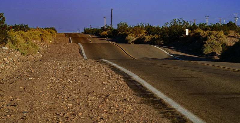
Road to Sitgreaves Pass – current Here’s an interesting factoid. Even in the 1920’s, this pass was known to be a very steep and treacherous drive. As such a lucrative business for locals became pulling cars over the pass with mule teams so that the car owners didn’t have to risk driving the road. One factor that played into this was that the Ford Model “T” was a quite popular touring car in the 1920’s and was instrumental in putting everyday people on the road all across the country. The model “T” was a bare bones vehicle priced such that a burgeoning middle class could afford them. One of the cost saving design features was a gravity feed fuel system. The gas tank was mounted a bit higher than the engine under the front seat and gravity would allow the gas to flow down to the engine without the need of a fuel pump. But, on the 12% grade going up Sitgreaves Pass the engine was higher than the gas tank and you didn’t go. Many adventurous drivers solved this problem by going up the pass backwards. Many weren’t that good at driving around hairpin curves backward and backed right off the road. Sitgreaves Pass, c. 1920’s to 1940’s Our family drove this road many times in the 1950’s without having to go up the hill backwards In the 1950’s I remember our summer trips as being almost exclusively on 2 lane roads packed with vacationers and big trucks. Up a hill, down a hill, round a curve, pass a truck, creep up the next grade behind a sad car laboring to pull a much too heavy trailer as we crept along at 10 mph waiting for an opportunity to pass. No passing lanes in those days, you just had to wait for a straight-a-way with the dotted line on your side and hope for a gap in oncoming traffic big enough for you to get by the slow poke. As my brother and I tried to fall asleep on a bed made of foam rubber in the back of the station wagon (seat belts were still more than a decade away), I remember that with my eyes closed, the sounds of driving were magnified. The “click-click-click” of the turn signal when passing a slower car, the “click-clack” of the foot operated high beam switch at night and the “thunk” sound as my dad flicked a switch to engage the over drive. And, almost always the sound of the wind through open windows. In those days every road went right through the middle of every town, usually on Main or First Street. Sometimes it would widen out to 4 lanes in the bigger towns but it was still slow going from red light to red light. I remember hearing my mom and dad mention town names like Baker, Kingman, Winslow, and Needles among others while staring at a paper gas station or AAA map discussing where to turn onto a different highway, or where to gas up or have dinner or find a motel. Between the slow slog through towns and getting stuck behind slow moving vehicles between towns, I think I heard my dad say one time that for planning purposes you could figure on averaging 30 or at most 35 mph on such a trip. Pretty different than these days when you can average closer to 60 mph on such a trip including rest stops. The road surfaces were usually pretty good but they did not make much of an effort during construction to widen out curves or to level out small ups and downs as they built the roads. We called these little roller coaster sections “whop-de-doos” and sitting on a mat way back by the tail gate as kids, we got quite a bounce out of them. Route-66 “whoop-de-doo’s” just east of Barstow For a while we pulled a small tear-drop trailer where mom and dad slept with my brother and I in a tent or more often just in a sleeping bag in the back of the station wagon or on a tarp or moving mat on the ground – it hardly ever rains in the SW in the summer so just sleeping on the ground was quite viable. We had a square wire rack on the top of the car which sat on four suction cups with tie down straps hooked to the rain gutters over the car doors. You can see this in the prior photo of the car in 1954. We would load up that rack with our suitcases and camping gear. From time to time something would not be tied down well or a rope would break and something would fly off. Sometimes we wouldn’t even know till we got to the campground and wondered where some item had gone to. One time I recall one or two of our suitcases flying off the roof and scattering clothes along the highway in some long forgotten stretch of desert. But memories aside, about the only thing we found on this 2023 trip in the section of Old Route-66 just east of Barstow was a set of “Whop-de-doo’s”. I’m 100% sure that in the 1950’s we drove this section of US-66 on our way to the Grand Canyon as well as other places so it is quite possible that this is the place where I recalled the roller coaster road. As I travel through the Southwest I like watching all the varied geology in the hills and ridges. It seems that each ridge has different rock formations, strata, and different colors than the one before. Some are green from copper. Others are more reddish from iron or other colors like blue or violet from other mineral deposits. Between the ridges the road bridges over hundreds of dry washes that flood during the monsoon season. Many of these are marked with names like “Trans Ditch”, “Bristol Mountain Wash” (no idea where Bristol Mt. is), “Orange Blossom Wash” (odd as there are no orange trees within 500 miles), “Bandit Gulch”, and “Marble Creek.” Final CommentThank for reading this and I hope you enjoyed it. Nobody paid me to write this article. I have no sponsors. I have no advertisers. If you appreciate the effort I put into article such as this one, please spend a few minutes and leave a thoughtful comment. That’s it! If you feel especially motivated also post a review on Google and/or Yelp for “Dan Hartford Photo”. Free to you, very helpful to me. To leave a comment without having to register, send it to me via the "Contact+About" menu and I'll post it for you (include the blog number or name).
====================================
PLEASE LEAVE COMMENTS AS I ENJOY HEARING YOUR REACTION O WHAT I'VE WRITTEN This blog is posted at: https://www.danhartfordphoto.com/blog/2026/5/rt-66-then-and-now Check my travel blogs for other trips here: https://www.danhartfordphoto.com/blog/keyword?k=DanTravelBlog
Thanks for reading – Dan
(Images by Dan Hartford unless otherwise noted.--Info from my own memory, Wikipedia, Google Gemini, ChatGPT, other web sources, pamphlets gathered at various locations along the way, guidebooks, and commentary by the local guides.)
Keywords:
blog,
Burma Shave Signs,
CA,
dan hartford photo,
dantravelblog,
dantravelblogRt-66,
Desert driving in the 50's,
Driving desert US-66,
Hackberry,
I-40,
I-40 in AZ,
Kingman to Seligman,
Ludlow,
Oatman,
Route-66,
Route-66 ruins,
Seligman,
Sitgreaves Pass,
Topock to Kingman,
US Highway System,
US-66,
US-66 through Arizona in the 1950's
Comments
Aavo & Fran(non-registered)
Hi Dan.,
Great show about Rt 66. We have driven part of it. From Arizona to California. I had my 90th birthday last year. We do not travel any more. Both of us get tired if we walk some distance. Instead we look at our travel DVDs, travel shows on TV and of course your excellent travel shows. It is a thrill to yell out out: "we have been there" So keep traveling. And stay healthy. Aavo and Fran
Bruce McGur(non-registered)
Hi Dan, great job with the very informative article on Rte 66! Jan and I drove from the Bay Area to Las Vegas last summer and went through Bakersfield and Barstow along the way in some very hot weather - 90+. As we approached Bakersfield, the front end of the van started to vibrate, and we pulled off to find some shade to look over the vehicle. I thought it might be a delaminated tire and the bubble was causing the vibration, but I could not find it. We did not dare continue into the Mojave Desert in the midday heat. It was Sunday, so few gas stations were open and we ended up spending the night. A Dodge dealer put the van up on a lift Monday morning and found the bubble on the inside sidewall - no wonder I missed it. Four new tires, and we were on our way, but driving around that strip of 66 was great - so many relics, so many in ruins, but some prospering with the tourism. You did mention the 1946 song, "Get your kicks on Rte 66", popularized later by Nat King Cole and the Rolling Stones!
Thanks for the great stories and old photos! Loved your dad's water tank and spray system...... Regards, b
Jim C(non-registered)
Very interesting blog about Route 66! I drove parts of the Route when I moved from Minnesota to California in 1967. In those days I had little to no money and stayed in crappy hotels. The hotel I stayed at in Albuquerque had a fire the night I stayed there! We had to evacuate at 3:00 in the morning.
We took two long family driving trips when I was a kid. The first trip was to the East Coast in 1960 in a station wagon and a 15-foot travel trailer. In Washington DC we parked very near the White House and went for a walk. My dad loved ice cream so we bought a half gallon on our way back to the car. When we started to leave the trailer hitch broke. My mother said, "What are we going to do now?" My dad said, "We're going to eat the ice cream before it melts"! A very helpful policeman arranged for us to get a tow. In 1962 we took a trip to the West Coast to see the World's Fair in Seattle. In some small town in Montana the water pump broke. We limped into the parking lot of the Sears store where my day took the old water pump out, exchanged it for a new pump in the Sears store and installed it in the parking lot. The total down time was less than 30 minutes.
Kingston B.(non-registered)
Thanks for sharing. I always enjoy your photos and trip information.
I have fond memories of our Road Scholar trip to SE Asia and meeting you folks Kingston
Louise Kingsley (from Inside Japan trip)(non-registered)
I really enjoyed your article. I like taking road trips and have fond memories of road trips with my parents. I’ve wanted to see the old portions of Route 66 and realize that there isn’t very much left to see. Your descriptions were very interesting and informative. Thanks again for posting.
No comments posted.
Loading...
|