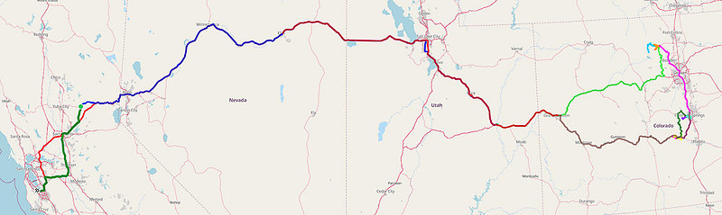
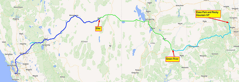
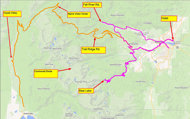
Colorado #01 - PA to Estes Park & RMNPSeptember 2026 Trip Colorado Trip 2026 #01 – Palo Alto to Estes Park & Rocky Mt. NPIn mid September, 2026 we embarked on a road trip from our home in Palo Alto California (near San Francisco) to see the sights in the mountains of Colorado. In order to get past the Sierra Nevada mountain range along the eastern edge of California, there are really only two basic routes between the San Francisco area and the Rocky Mountains of Colorado. One is looping south Barstow then turning northeast through Las Vegas, Utah, and into Colorado. The other is the more direct route looping a bit to the north and basically following I-80 over Donner Pass in the Sierra’s across northern Nevada and into Utah and dipping SE into Colorado and the Rockies. But either way, it’s a 3 day drive (19 - 21 hours without stops). As we have made many trips going through Barstow and into the Southwestern US, we opted for the less interesting I-80 route. Full Trip map This episode covers California to Colorado and Rocky Mountain National Park Getting to Colorado
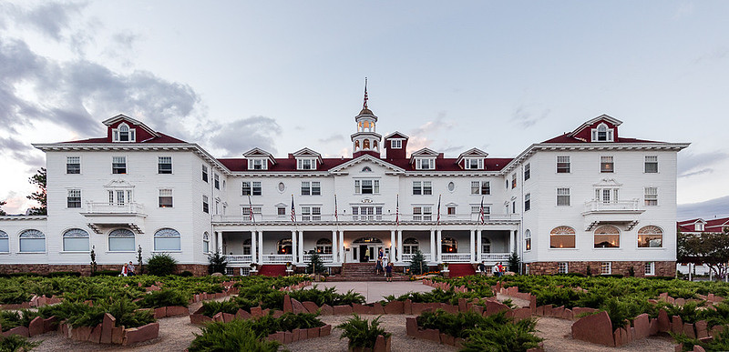
Getting from Palo Alto to the Rocky Mountains in Colorado is a three day drive which takes you over Donner Summit in the Sierra’s, then across the Great Basin desert of Northern Nevada and into Utah. Nothing much to report about this segment. But, the road condition of I-80 once you get out of California is exceedingly better now than the last time we drove this route. The right lane no longer has deep ruts from the heavy truck traffic and in general the road surface is quite smooth for those 75 and 80 MPH speed limits. This was mid September, before any real snowfall would have pushed truck traffic down to a more southern route so I was surprised at how few big trucks were on the road. On the other hand, the price of diesel fuel was hitting $6.00 per gallon thanks to Trumps war in Iran not to mention the decline in foreign goods coming and going from the country due to Trump’s tariffs, so perhaps it should not have been a surprise that truck traffic was significantly lower than it was even few years ago. But our weather was good (a bit windy but when isn’t it windy in that part of the country). We spent a night in Elko, NV after an 8 hour drive. The next day we continued east past the Great Salt Lake, turned SE and landed in Green River Utah for the night. And on our 3rd day out we continued east on I-70 and into the Rocky Mountains. Along the way, I-70 goes through the Eisenhower–Johnson Memorial Tunnel beneath the Continental Divide at an elevation of 11,158 feet (3,401 meters) above sea level, making it the highest point on the U.S. Interstate Highway System. We had a great view of this area as there was a lot of road construction and we were stopped much of the time. This route also took us through the famous (and quite upscale) Vail Colorado where there were several dozen 5/6 story apartment/condo complexes in varying stages of being constructed. This place is really booming for those who can afford it. Rather than continuing on to Denver and taking an interstate north we exited I-70 early and took 2 lane backroads through the lower portions of the mountains (CO-119 and CO-72) up to Estes Park – a much nicer drive and given the traffic in the Denver area, probably faster anyway. Estes ParkEstes Park is a town right next to the eastern entrance to Rocky Mountain National Park. In Colorado, unlike a city playground, a "park" is an open, relatively flat or rolling mountain basin ringed by higher peaks. French and English trappers and explorers used the term parc for these, game-rich basins that resembled natural hunting preserves. Broadly, the English word park traces back to enclosed lands or game reserves. So, we have “Estes Park” which is a city not a park. Colorado has kept this tradition with many places having “park” as part of their name. Estes Park with a population of around 6,000 sits at 7,743 feet (2,360 meters) in a circular valley. Prior to being invaded by Anglo settlers, the region was occupied on and off by groups including the Ute and Arapaho who used the high country seasonally. In the 1800’s explorers and trappers came along including Major Stephen H. Long in 1820, for whom Longs Peak is named. But the current town can be traced back to Joel Estes who entered the valley in 1859 looking for gold. He homesteaded with his family in 1860 and in 1864 Rocky Mountain News editor William Byers named the area after Estes. By 1866 Estes had had enough of the harsh climate and sold his property to Griff Evans and departed the area. Griff established early guest cabins and a dude ranch. British writer Isabella Bird visited in 1873 and later chronicled the area in ‘A Lady's Life in the Rocky Mountains’ (1879). Moving along into early 1900’s, Naturalist Enos Mills pushed for the establishment of Rocky Mountain National Park and his efforts succeeded in 1915 when the park was established and the tourist trade accelerated. In 1909 F.O. Stanley opened the Stately Stanley Hotel. This name may not mean much to you until I mention that Mr. Stanley invented and produced the “Stanley Steamer” automobile. His tie to the car business coupled with his hotel was a major factor in the influx of new ‘mobile’ tourists who did not rely on train tracks to get to interesting places.
We did not stay there. In general lodging in Estes Park is not for the faint of wallet and The Stanley is at the top of the list in terms of price ($400+ USD per night). Instead we opted for what sounded like a very nice place called “The Expedition Lodge”. Photos looked great. Reviews were good. Price was manageable. Unfortunately it did not live up to expectations. It turned out to be a 1960’s era hotel that has not been kept up all that well. It was clean and the front desk and restaurant staff were pleasant, but the facility really needed a re-do.
Rocky Mountain National ParkRMNP (Rocky Mountain National Park) is right next to Estes Park and is the main reason Estes Park is what it is today. RMNP is about 55 miles NW of Denver in a section of the Rocky Mountains called the Front Range. I guess as settlers came across the plains in their covered wagons, this was the first part of the range they encountered and was thus the Front Range. Of course if Columbus had landed on the west coast, I guess it would be the ‘Back Range’. The park was created in 1915 during the Woodrow Wilson administration and was the 10th or 11th national park, depending on how you count. However, due to some subsequent park mergers, it is number 9 in the current crop of NP’s. When created it was 360 sq mi but since then has grown to a bit over 415 sq mi. It is the 3rd most visited National park with over 4 million annual visitors. The Continental Divide runs directly through the center of the park with water flowing to the Pacific Ocean via the Colorado River on the west side (unless it is used up along the way) and flowing to the Gulf of Mexico and Atlantic Ocean via several tributary rivers that drain into the mighty Mississippi River on the east side. As it turns out the headwaters of the Colorado River are located in the park's northwestern region near Poudre Lake. There are several (5) visitor centers in the park. The Beaver Meadows Visitor Center at the Estes Park Entrance is a National Historic Landmark designed by the Frank Lloyd Wright School of Architecture.
We spent two days driving in RMNP.
Navigating the intricacies of accessing RMNC is a challenge. In 2026, in addition to RMNP there were only 3 other NP’s that still required visitor reservations (other than hotels and campgrounds).
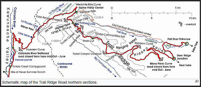
Starting in 2026, the Trump Administration decided to ‘stick it to California’ and required Yosemite to drop their seasonal visitor reservation requirement even though over 4.3 million visitors show up each year with a vast majority of them all heading to one small valley. This resulted in increased crowding. Massive traffic jams, longer entrance lines, fuller parking lots, and environmental concerns around popular areas like Yosemite Valley, El Capitan, and Half Dome. At peak times in the summer and holiday weekends it can take up to 2 hours just to get past the entrance booth and then another 2 to 3 hours stuck in traffic just to get to your lodging or campground. But, RMNP was allowed to retain their reservation system. From Estes Park you can get to the Beaver Meadows Visitor center without a pass but to get into the rest of the park you need a timed reservation that you can get online or at the visitor center. This entrance reservation and small fee is in addition to the park entrance fee. But to make life complicated there are two different entry passes. One is for access to the Bear Lake Road which also allows access to the rest of the park and the other pass is for everything EXCEPT Bear Lake Road. On our visit, by the time we figured out that even after labor day, RMNP required an entry reservation, the Bear Lake passes were sold out for the next day. But they still had 4 passes of the non-Bear Lake type on the next day so even though they were for around lunch time we grabbed one. At the same time also got one of the Bear Lake passes for the day after in mid morning. Trail Ridge RoadIn the 1930’s, Roosevelt’s Civilian Conservation Corps (part of the New Deal) built the main automobile route in the park. This is the Trail Ridge Road and is still considered a significant feat of engineering. Trail Ridge Road is the name for a 48-mile (77 km) portion of U.S. Highway 34 that traverses Rocky Mountain National Park from Estes Park, in the east to Grand Lake in the west. It is the main portion of the Trail Ridge Road/Beaver Meadow National Scenic Byway, an All-American Road. With a high point at 12,183 feet (3,713 m), Trail Ridge Road is the highest continuous paved road in North America with 11 miles above the timber line. The higher portion of Trail Ridge Road is closed from October to May. The road crosses the Continental Divide near Milner Pass (elev. 10,758 ft or 3,279 m) but reaches a maximum elevation of 12,183 ft (3,713 m), near Fall River Pass.
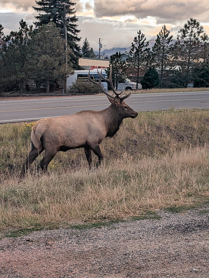
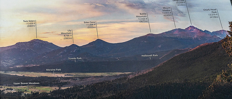
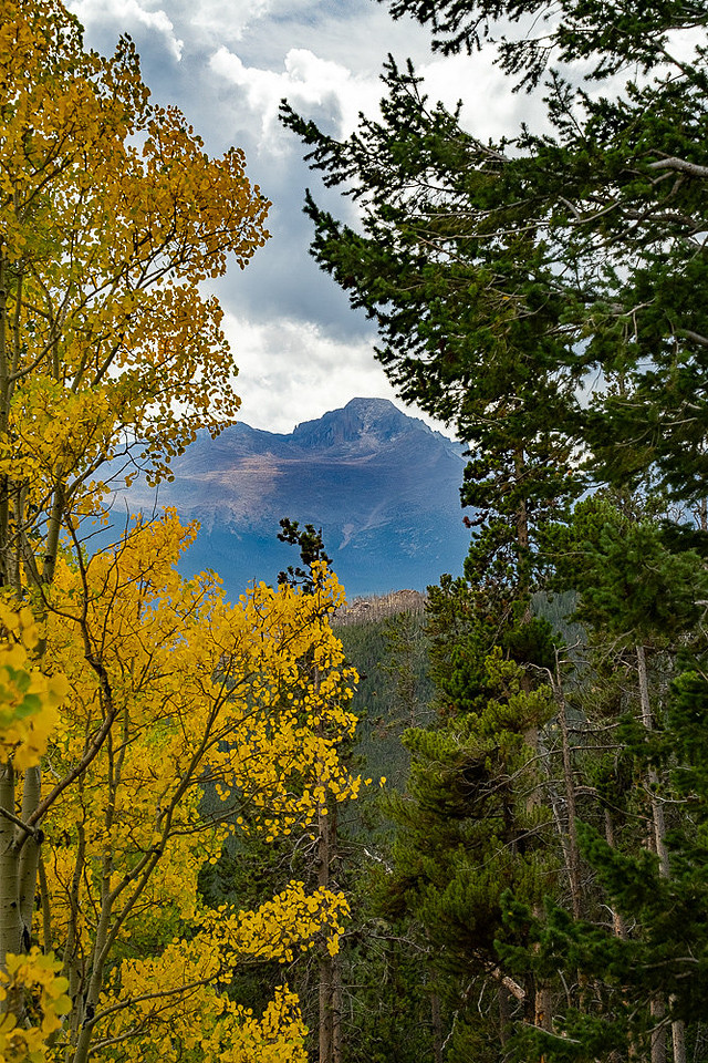
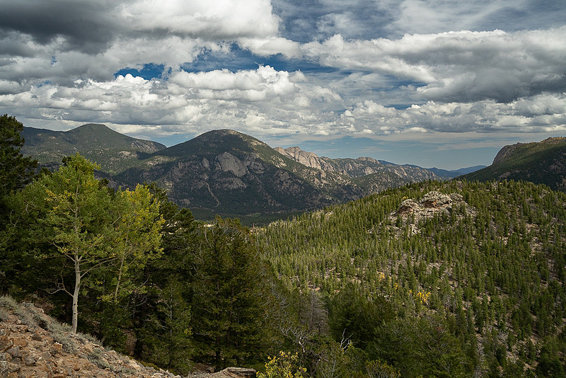
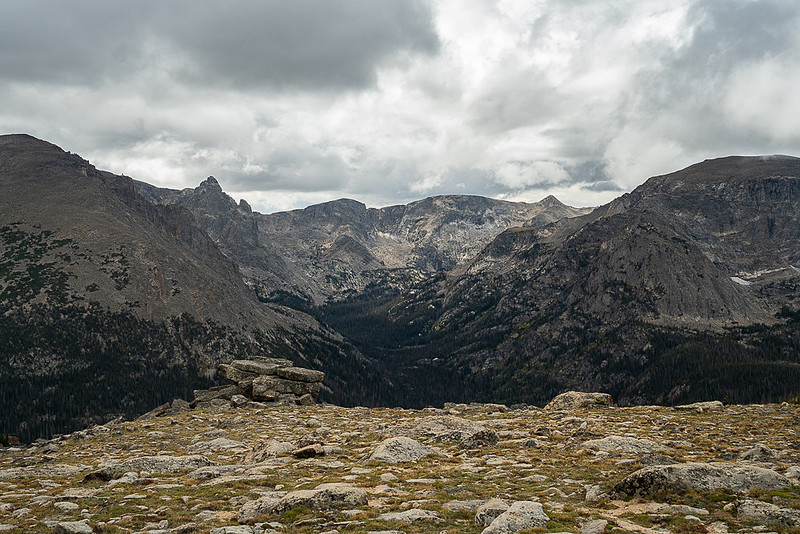
Trail Ridge itself had been used by Native Americans for hundreds of years to cross the mountains between their home lands in the west and hunting areas on the east side. Arapahoe Indians called the trail located on the ridge as "taienbaa" ("Where the Children Walked") because it was so steep that children could not be carried, but had to walk. The Ute tribe crossing the mountains at Forest Canyon Pass marked their route with stone cairns. The present Ute Trail in the park partially follows that ancient route. Roads into what is now RMNP stared in the 1880’s. The first one, on the west side, was a dirt wagon road up the Kawuneeche Valley from the town of Grand Lake up to some mining camps and was carved out around 1880. But those camps were abandoned a few years later and the road fell into disuse other than for the odd hunter or tourist. The next road into the park was opened in 1921 and is the Old Fall River Road on the east side. The route followed what was known to local Arapaho Indians as the Dog Trail as they used large, wolf-sized, dogs to pull sled-like wooden frames called travois over the snowy mountain passes. When the road was built it was useless for motor vehicles as it was a single-lane with steep grades (up to 16%), tight curves and a short annual season. From early July to mid October you can still drive this road, at 15 mph, one way, uphill going east to west. It is still dirt and still has those 16% grades, no guardrails, and hairpin curves. It meets up with the Trail Ridge Road near the Alpine Visitor Center at 11,796 ft. Construction on the Trail Ridge Road began in 1929 and the road was completed between Estes Park and Fall River Pass by July 1932. It wasn’t until 1938 that the eastern portion of the road was completed to Grand Lake. Unlike the Old Fall River Road, this one has a maximum grade of 7%, is paved, has some tight – but manageable – curves and is not particularly narrow. Although there was some opposition to the construction of a road through the park's alpine tundra it was designed to intrude as little as possible into the landscape. Trail Ridge Road (East of summit at Milner Pass)The eastern part of the road goes through some large meadows where various forms of wildlife are often seen. The easiest way to spot elk, moose, bear, beaver and other critters is to just look for a bunch of cars stopped on the highway in front of you and look where they are looking. If you don’t see anything it is probably because the animal left 20 minutes ago but the cars keep stopping when they see other cars stopped. About 4.3 miles up the road from the Beaver Meadow Visitor center there is a fork in the road where you can take a cutoff to the right which takes you into an adjoining valley where it intersects the Old Fall River Road (paved, 2 lane, section). As you continue up Trail Ridge Road there are several ‘vista point’ pull offs and parking lots. These can get quite full during the season but they are well worth it, even if you have to hang out a bit waiting for a parking spot to open up. Most folks only stay 5 to 15 minutes at each one so there is decent turn over of parking spots. Due to our reserved late entry time, and as time was slipping away and we had a lot of road still waiting to be explored we only stopped at two of these vista points on the east side. One of the first major ones you come to is the Many Parks Curve Overlook at an elevation of 9,640 ft (2,938 m). Remember, these “Parks” are not separate National or State Parks but rather small valley’s surrounded by mountains. In the photos below you can see several of these grassy ‘parks’.
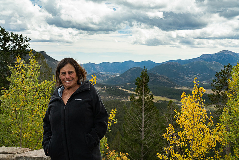
Ellen at Many Parks Curve overlook
The other one we stopped at was a small parking lane at the Ute Trailhead.
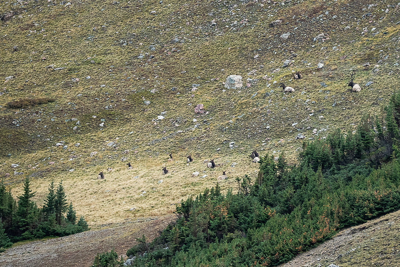
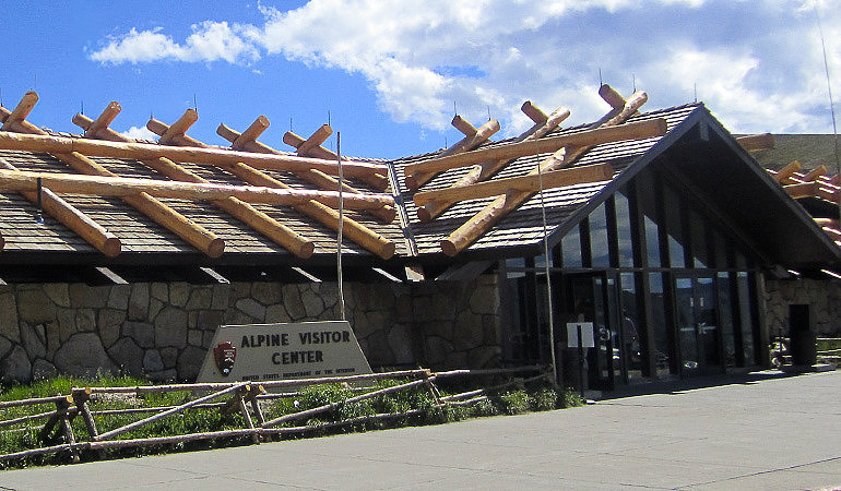
Alpine Visitor CenterA mile past Milner Pass which is the highest point on Trail Ridge Road at 12,183 ft (3,713 m) we came to the Alpine Visitor Center. Even though Milner Pass is the highest point on the road, it is not the Continental Divide which is another 5 miles along the road. The Alpine Visitor Center at Fall River Pass (11,796 ft, 3,595 m) is the highest visitor center in the National Park System. Even though it was T-shirt weather down at Beaver Meadows when we started out in the park it was quite chilly up here with a cracking good breeze and snow flurries coming and going. So we just headed straight into the visitor center where it was warm and out of the wind – as did almost every other person whose car was in the large parking lot. There are some large, floor to ceiling windows on the back side of the building and in a clearing below was a herd of elk. Notice the stag in the upper right overseeing his harem.
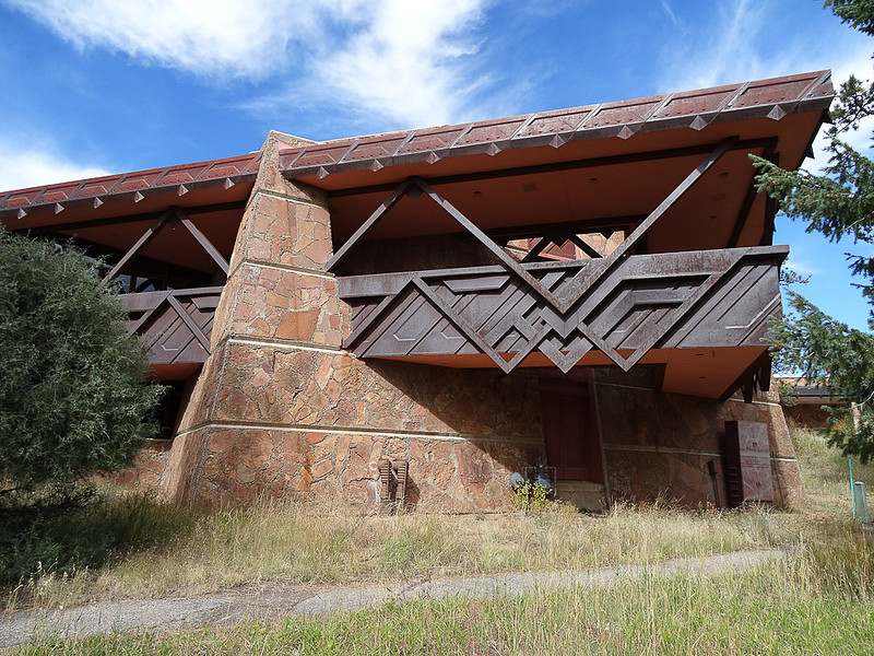
While the road was opened 1932 this visitor center didn’t come along for another 33 years. It was dedicated in 1965 as the park's first visitor center built under the National Park Service's Mission 66 program. This program was created after World War II due to rising park visitation. It was designed to upgrade aging facilities ahead of the National Park Service's 50th anniversary in 1966. For 8 months out of the year harsh winter alpine weather on this exposed saddle at 11,796 ft. includes hurricane force winds and deep winter snow many times exceeding the height of the building itself. The building was engineered to withstand these conditions, balancing mid-century openness with alpine durability. Among other things it combines a modern steel-and-concrete frame with rugged, weather-resistant natural materials including exterior stone veneer with rustic wood beam finishes. One of the noticeable features one can’t miss is the shingled gabled roof with a lattice of huge peeled logs on top. Rather than being purely decorative, this log grid adds ballast to hold the roof down against fierce high-altitude winds.. Notice the height of the snow poles at that front of the building.
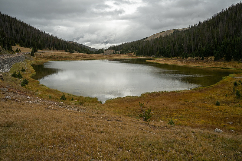
Trail Ridge Road (West of Alpine Visitor Center)Continuing another 5 miles west bound on the Trail Ridge Road, we dropped down 1,000 ft and stopped at Poudre Lake. Not very large but pretty to look at.
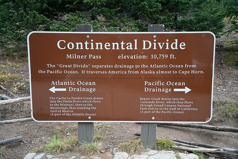
Poudre lake drains to the north east at the far end in this view eventually flowing all the way to the Gulf of Mexico. Just behind me though, at the other end of the parking lot is the continental divide where things start draining toward the Pacific Ocean.
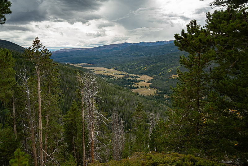
Continuing down the western side we stopped at Farview Curve Viewpoint, and its name is not misleading.
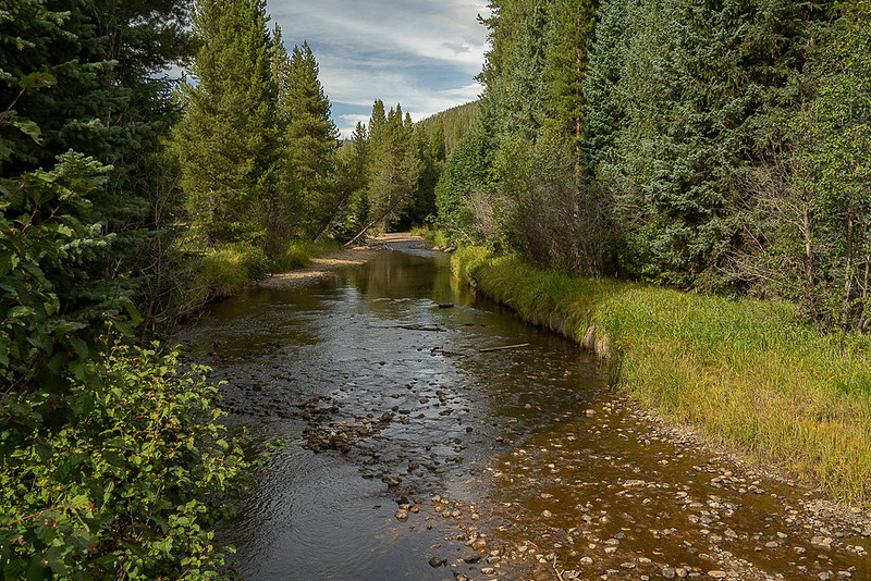
The road continues through the Coyote Valley and one of the stops is at the Coyote Valley Trailhead. Right by the parking lot is a pedestrian bridge over a picturesque stream lazily flowing through a forest. That stream happens to be the Colorado River.
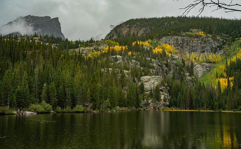
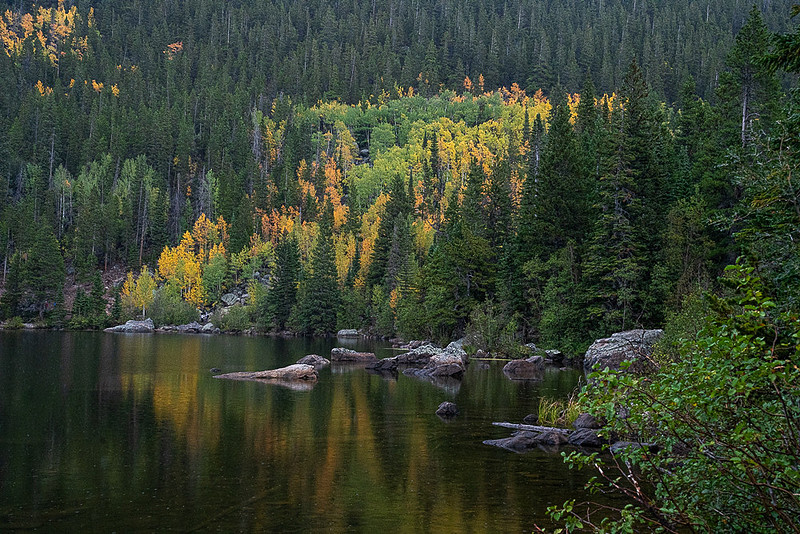
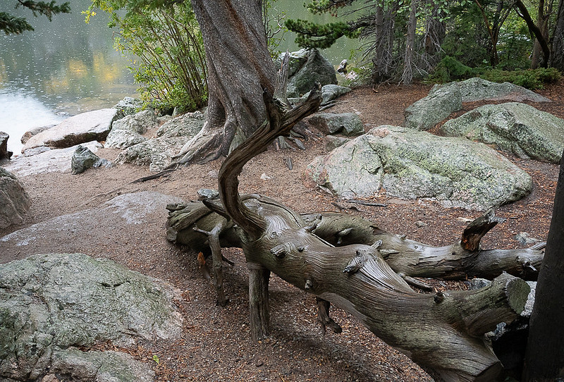
The actual headwaters of the Colorado is a bit higher and to the north on the Continental Divide at La Poudre Pass (about 10,184 feet in elevation) where snowmelt and wet meadows feed the river's earliest trickle. Quite a different look than what you experience running the rapids through the Grand Canyon. The Trail Ridge road continues on, ending just past at a visitor center before you exit the park at the town of Grand Lake. Bear LakeBear Lake is a high sub-alpine lake sitting beneath Hallett Peak at 9,475 feet. It is quite popular with hikers as many significant and popular trails start at, or pass by the lake. The lake itself is not all that large at only about 11 acres but it is quite pretty with mountains behind it and forests and rock formations around it. Bear Lake is perhaps the most popular hike in Rocky Mountain National Park. A gentle 0.6 to 0.7 mile trail leads you around the small lake, giving you several very beautiful views of the surrounding mountains while also giving you a taste of the lower end of Rocky’s subalpine zone. Of course indigenous peoples and early settlers used the area historically but the lake was officially named in 1912 after a hunter who shot at a bear at the lake. At one time conservationist Enos Mills wanted to build a dam here to make the lake bigger, but that never happened. However in 1915—the year the park was established—E.A. Brown received permission to build Bear Lake Lodge with a log kitchen and rental tents. Later, in the 1920’s, Frank W. Byerly expanded the property. And Frank H. Cheley established a boys' camp and the Bear Lake Trail School there in 1923. None of this is still present. As mentioned before, most of the season you need a “Bear Lake” timed entrance pass to drive the road to Bear Lake. But even with the pass you are not out of the woods, so to speak. Although the parking lot at Bear Lake is one of the largest lots in the park, it routinely fills early (often between 4:30 a.m. and 8:30 a.m. in peak summer/fall season). But there is a large parking lot at Glacier Basin Campground which is about half way up the Bear Lake Rd. From there, in peak season, there is a free shuttle bus that takes you up to Bear Lake that runs about every 10 to 15 minutes with stops along the way at all the same places you could park your car if you drove. It was raining on an off (mostly on) during our visit to Bear Lake. While the trail around the lake is pretty gentle for a leisurely stroll, navigating it with a small wheeled walker, which my wife uses, is quite a challenge. Although hard to push on the dirt/gravel it was barely manageable. However about a quarter of the way around (each way) there were larger obstacles such a narrow space between boulders and places where you had to step up or down over rocks, and roots that were just not practical with a walker. Once we hit those spots we turned back. But, even in the rain with a not quite “accessible” trail it was still a very pretty lake and well worth a visit.
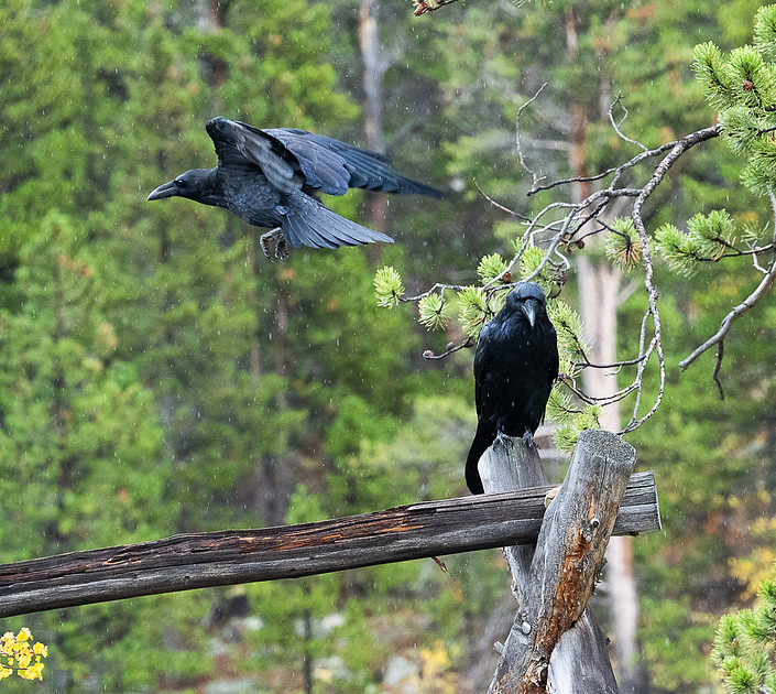
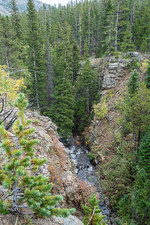
Prospect Canyon OverlookOn the way back down from Bear Lake we noticed a small parking lot with no one in it so figured we’d take a look. Turns out it was the Prospect Canyon Overlook guarded by two crows sitting on a fence. The ‘Canyon’ is quite small but steep carved by stream erosion after glaciers retreated from the area. Apparently there is an abandoned mine tunnel here someplace dug along an intrusive dike which from a mining perspective amounted to nothing. We didn’t see the tunnel and in the rain didn’t feel like wandering around looking for it.
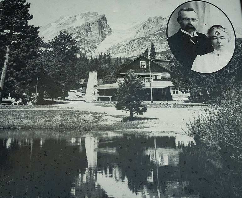
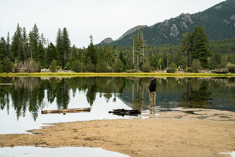
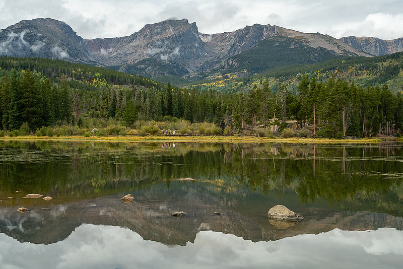
Sprague LakeAlso along the Bear Lake road is Sprague Lake. At around 13 acres it is a bit larger than Bear Lake but with a completely different vibe. Unlike Bear Lake this one is partially man made, and is in a wider valley than Bear Lake giving it an open feel with the mountains more as a backdrop than in integral part of the lake. Abner Sprague (a guide and host) homesteaded here with his wife Alberta in 1874 and in the early 1900’s built a resort which opened in 1910. Just before RMNP was created in 1915 they enlarged the lake by damming it with an earthen levy in order to create better fishing for guests. The park service purchased this land in 1932 and it became part of the park but Abner and Alberta continued to operate the Lodge for another 8 years till 1940. An interesting side note is that it seems Abner was the first person to pay an RMNP entrance fee to the park.
And that’s it for this segment of our Colorado trip. Next up is Royal gorge followed by Phantom canyon, Victor and Cripple Creek, Pikes Peak and Grass Valley back in California. Thanks for reading ====================================PLEASE LEAVE COMMENTS ON MY WEBSITE AS I ENJOY HEARING WHAT YOU THINK ABOUT WHAT I'VE WRITTEN This blog is posted here where you can leave comments: https://www.danhartfordphoto.com/blog/2026/11/colorado-01-pa-to-estes-park-rmnp Or, the whole series for this trip as they are created: https://www.danhartfordphoto.com/blog/keyword?k=dantravelblogcolorado2026 All my travel blog articles can be found here: https://www.danhartfordphoto.com/travel-blogs All photos from this trip are at this link: https://www.danhartfordphoto.com/usa-co-colorado-rockies-2026-09
Thanks for reading – Dan
(Images by Dan Hartford unless otherwise noted. Info from Wikipedia, various chatbots, other web sources, pamphlets gathered along the way, guidebooks and commentary by the local guides.
Keywords:
Alpine Visitor Center,
Bear Lake,
blog,
CO,
Colorado,
dan hartford photo,
dantravelblog,
dantravelblogColorado2026,
Estes Park,
Fall River Road,
Palo Alto to Estes Park,
RMNP,
Road Trip,
Rocky Mountain National Park,
Sprague Lake,
Trail Ridge Road
Comments
No comments posted.
Loading...
|